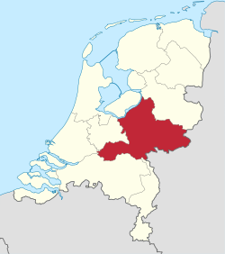
Gelderland (Dutch pronunciation: [ˈɣɛldərlɑnt](listen), also Guelders in English) is a province of the Netherlands, located in the central eastern part of the country. With a land area of nearly 5,000 km2, it is the largest province of the Netherlands and shares borders with six other provinces and Germany.
The capital is Arnhem. However, both Nijmegen and Apeldoorn are larger municipalities, Nijmegen being the largest with nearly 170,000 inhabitants. Other major regional centres in Gelderland are Ede, Doetinchem, Zutphen, Tiel, Wageningen, Zevenaar, Winterswijk and Harderwijk. Gelderland had a population of just over two million in 2015.[2]
Contents
1History
2Geography
2.1Municipalities
2.2Abolished municipalities
3Cultural references
4References
5External links
History
Historically, the province dates from states of the Holy Roman Empire and takes its name from the nearby German city of Geldern. According to the Wichard saga, the city was named by the Lords of Pont who fought and killed a dragon in 878 AD. They named the town they founded after the death rattle of the dragon: "Gelre!"[3]
The County of Guelders arose out of the Frankish pagus Hamaland in the 11th century around castles near Roermond and Geldern. The counts of Gelre acquired the Betuwe and Veluwe regions and, through marriage, the County of Zutphen. Thus the counts of Guelders laid the foundation for a territorial power that, through control of the Rhine, Waal, Meuse and IJssel rivers, was to play an important role in the later Middle Ages. The geographical position of their territory dictated the external policy of the counts during the following centuries; they were committed to the interests of the Holy Roman Empire and to expansion south and west.
Further enlarged by the acquisition of the imperial city of Nijmegen in the 13th century, the countship was raised to a duchy in 1339 by the Holy Roman Emperor, Louis IV. After 1379, the duchy was ruled from Jülich and by the counts of Egmond and Cleves. The duchy resisted Burgundian domination, but William, Duke of Jülich-Cleves-Berg was forced to cede it to Charles V in 1543, after which it formed part of the Burgundian-Habsburg hereditary lands.[4]
The duchy revolted with the rest of the Netherlands against Philip II of Spain and joined the Union of Utrecht (1579). After the deposition of Philip II, its sovereignty was vested in the States of Gelderland, and the princes of Orange were stadtholders. In 1672, the province was temporarily occupied by Louis XIV and, in 1713, the southeastern part including the ducal capital of Geldern fell to Prussia. Part of the Batavian Republic (1795–1806), of Louis Bonaparte’s Kingdom of Holland (1806–10), and of the French Empire (1810–13), Gelderland became a province of the Kingdom of the Netherlands in 1815.[4]
During the Second World War, it saw heavy fighting between Allied Paratroopers, British XXX Corps and the German II SS Panzer Corps, at the Battle of Arnhem.
Geography
Gelderland can roughly be divided into four geographical regions: the Veluwe in the north, the Rivierenland including the Betuwe in the southwest, the Achterhoek (literally meaning the "back corner") or Graafschap (which originally means earldom or county) in the east and the city-region of Arnhem and Nijmegen in the centre-south.
Clash Royale CLAN TAG #URR8PPP This is a list of notable events in country music that took place in the year 1996. 1996 in music By location United Kingdom Norway South Korea By genre country heavy metal hip hop jazz Latin By topic List of albums released Overview of the events of 1996 in country music List of years in country music (table) ... 1986 1987 1988 1989 1990 1991 1992 ... 1993 1994 1995 1996 1997 1998 1999 ... 2000 2001 2002 2003 2004 2005 2006 ... Art Archaeology Architecture Literature Music Philosophy Science +... Contents 1 Events 2 Top hits of the year 2.1 Singles released by American artists 2.2 Singles released by Canadian artists 3 Top new album releases 3.1 Other top albums 4 Births 5 Deaths 6 Hall of Fame inductees 6.1 Bluegrass Music Hall of Fame inductees 6.2 Country Music Hall of Fame inductees 6.3 Canadian Country Music Hall of Fame inductees 7 Major awards 7.1 Grammy Awards 7.2 Juno Awards 7.3 Academy of Country Music 7.4 ARIA Awards 7.5 Can...
Clash Royale CLAN TAG #URR8PPP Pawn Stars is an American reality television series that premiered on History on July 19, 2009. The series is filmed in Las Vegas, Nevada, where it chronicles the activities at the World Famous Gold & Silver Pawn Shop, a 24-hour family business operated by patriarch Richard "Old Man" Harrison, his son Rick Harrison, Rick's son Corey "Big Hoss" Harrison, and Corey's childhood friend, Austin "Chumlee" Russell. The descriptions of the items listed in this article reflect those given by their sellers and others in the episodes prior to their appraisal by experts as to their authenticity, unless otherwise noted. .mw-parser-output .tocrightfloat:right;clear:right;width:auto;background:none;padding:.5em 0 .8em 1.4em;margin-bottom:.5em.mw-parser-output .tocright-clear-leftclear:left.mw-parser-output .tocright-clear-bothclear:both.mw-parser-output .tocright-clear-noneclear:none Contents 1 Series overview 2 Episodes 2....

 Clash Royale CLAN TAG#URR8PPP