Hinsdale, Illinois

 Clash Royale CLAN TAG#URR8PPP
Hinsdale, Illinois | |
|---|---|
Village | |
| Village of Hinsdale | |
 | |
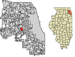 Location of Hinsdale in DuPage County and Cook County, Illinois. | |
| Coordinates: 41°48′2″N 87°55′41″W / 41.80056°N 87.92806°W / 41.80056; -87.92806Coordinates: 41°48′2″N 87°55′41″W / 41.80056°N 87.92806°W / 41.80056; -87.92806 | |
| Country | |
| State | Illinois |
| Counties | Cook, DuPage |
| Township | Downers Grove |
| Incorporated | April 1, 1873 (1873-04-01) |
| Government | |
| • Type | Council-manager |
| • President | Thomas K. Cauley, Jr. |
| Area [1] | |
| • Total | 4.65 sq mi (12.04 km2) |
| • Land | 4.62 sq mi (11.95 km2) |
| • Water | 0.03 sq mi (0.09 km2) 0.65% |
| Population (2010) | |
| • Total | 16,816 |
| • Estimate (2016)[2] | 17,631 |
| • Density | 3,820.37/sq mi (1,475.08/km2) |
| Down 3.07% from 2000 | |
| Standard of living (2013) | |
| • Per capita income | $79,836 |
| • Median home value | $765,890 |
| ZIP code(s) | 60521-60523 |
| Area code(s) | 630 and 331 |
| Geocode | 35307 |
| FIPS code | 17-35307 |
| Website | www.villageofhinsdale.org |
Demographics (2010)[3] | |||
|---|---|---|---|
White | Black | Asian | |
| 90.0% | 1.3% | 6.4% | |
Islander | Native | Other | Hispanic (any race) |
| 0.1% | 0.04% | 2.2% | 3.5% |
Hinsdale is a village in Cook and DuPage counties in the U.S. state of Illinois. Hinsdale is a western suburb of Chicago. The population was 16,816 at the 2010 census, most of whom lived in DuPage County.[3] The town's ZIP code is 60521, and it is listed in the top 1% of wealthiest towns in Illinois. It is known locally for its beautiful residences and teardown culture, of which new rebuilds have taken 30% of homes in the village. The town has a rolling, wooded topography, with a quaint downtown, and is a 22-minute express train ride to downtown Chicago on the Burlington Northern line.
Contents
1 Geography
2 Demographics
3 Housing and architecture
4 Government and infrastructure
5 Transportation
6 Education
6.1 Primary and secondary schools
6.2 Public library
7 Economy and business
8 Parks and recreation
9 Notable people
10 References
11 External links
Geography
Hinsdale is located 20 miles (32 km) west of Chicago and is bordered by Western Springs to the east, Clarendon Hills and Westmont to the west, Oak Brook to the north, and Burr Ridge and Willowbrook to the south. It can be reached by highway from Interstate 294 or Interstate 55. The eastern boundary of Hinsdale is I-294, and the western boundary is Route 83.
According to the 2010 census, Hinsdale has a total area of 4.633 square miles (12.00 km2), of which 4.6 square miles (11.91 km2) (or 99.29%) is land and 0.033 square miles (0.09 km2) (or 0.71%) is water.[4]
Demographics
| Historical population | |||
|---|---|---|---|
| Census | Pop. | %± | |
| 1880 | 819 | — | |
| 1890 | 1,584 | 93.4% | |
| 1900 | 2,578 | 62.8% | |
| 1910 | 2,451 | −4.9% | |
| 1920 | 4,042 | 64.9% | |
| 1930 | 6,923 | 71.3% | |
| 1940 | 7,336 | 6.0% | |
| 1950 | 8,676 | 18.3% | |
| 1960 | 12,859 | 48.2% | |
| 1970 | 15,918 | 23.8% | |
| 1980 | 16,726 | 5.1% | |
| 1990 | 16,029 | −4.2% | |
| 2000 | 17,349 | 8.2% | |
| 2010 | 16,816 | −3.1% | |
| Est. 2016 | 17,631 | [2] | 4.8% |
| U.S. Decennial Census[5] | |||
As of the census[6] of 2010, 16,816 people lived in Hinsdale. The racial makeup of the village was 90.0% White, 1.3% African American, 0.0% Native American, 6.4% Asian, 0.1% Pacific Islander, 0.5% some other race, and 1.7% from two or more races. Hispanic or Latino of any race were 3.5% of the population.[3]
The census recorded 5,488 households in the village, out of which 48.2% had children under the age of 18 living with them, 73.2% were headed by married couples living together, 6.6% had a female householder with no husband present, and 18.0% were non-families. 16.5% of all households were made up of individuals, and 8.5% were someone living alone who was 65 years of age or older. The average household size was 3.03, and the average family size was 3.43.[3]
According to the 2010 census, Hinsdale's age distribution amounted to 33.5% under the age of 18, 5.3% from 18 to 24, 17.4% from 25 to 44, 32.3% from 45 to 64, and 11.5% who were 65 years of age or older. The median age was 41.4 years. For every 100 females, there were 95.6 males. For every 100 females age 18 and over, there were 92.0 males.[3]
The median income for a household in the city was $165,598, and the median income for a family was $170,433. Males had a median income of $161,579 versus $77,292 for females. The per capita income for the city was $78,902. About 2.2% of the population was below the poverty line, including 3.8% of those under age 18 and 0.4% of those age 65 or over.[3]
Housing and architecture
Hinsdale's downtown area is a National Register Historic District.[7] The downtown area is located in the center of town and is remarkably little changed considering the many teardowns that have occurred in town. The village has restaurants, different types of shops, and various services, as well as the train station.
The Robbins Park district just east of downtown between Garfield Street and County Line Road, as well as between Hinsdale Avenue and 9th Street, is a National Register Historic District as well.[7] The district includes two of Hinsdale's seven buildings individually listed on the National Register of Historic Places, as well as seven of seventeen Hinsdale Historic Landmarks.[8]
The six individual Hinsdale buildings on the National Register of Historic Places are the Orland P. Bassett House at 329 E. Sixth St., the Robert A. and Mary Childs House at 318 S. Garfield Ave., Immanuel Evangelical Church at 302 S. Grant St., the Francis Stuyvesant Peabody House at 8 E. Third St. and the William Whitney House at 142 E. First St.[7]
Another significant architectural landmark is the R. Harold Zook Home and Studio, which was originally located at 327 S. Oak Street and was saved from demolition in 2005 by relocation to the Katherine Legge Memorial Park, 5941 S. County Line Road.[9]
To address Hinsdale's legacy of important architectural landmarks, the Hinsdale Historical Society runs the Roger & Ruth Anderson Architecture Center, which advocates for the preservation of Hinsdale's historical architecture and serves as an archive and resource.[10]
Government and infrastructure

The Hinsdale Memorial Building, the Village Hall and public library in the Downtown Hinsdale Historic District
The village was incorporated on April 1, 1873.[11] Law enforcement is provided by the Hinsdale Police Department.[12] The Hinsdale Fire Department was established in 1893.[13]
The community is served by the United States Postal Service Hinsdale Post Office.[14]
As of December 2014, the village president is Thomas K. Cauley, Jr. The village trustees are J. Kimberley Angelo, Christopher J. Elder, William N. Haarlow, Gerald J. Hughes, Laura LaPlaca and Bob Saigh.[15]
Transportation

The Hinsdale train station on the BNSF Railway Line
Hinsdale is served by Metra's BNSF Railway Line at three stations: West Hinsdale, Hinsdale, and Highlands. Additionally, Pace operates connecting bus services. Currently, Pace bus lines 663 and 668 serve Hinsdale.
Education
Primary and secondary schools
Community Consolidated School District 181 and the Hinsdale Township High School District 86 serve Hinsdale's youth.[16] The high school district has its headquarters in Hinsdale.[17]
The School District 181 elementary schools within Hinsdale include The Lane School, Madison School, Monroe School, and Oak School. Elementary schools in District 181 that are not in Hinsdale include Prospect School, Elm School, and Walker School. Hinsdale Middle School, operated by the elementary school district, is in Hinsdale. Clarendon Hills Middle School, which also is in District 181, is in Clarendon Hills. St Isaac Jogues is a K-8 Catholic Grade School School also located in Hinsdale.
Hinsdale Central High School is located in Hinsdale.[18]
Public library
The Hinsdale Public Library is located in the west wing of the Memorial Building.[16] The library opened in August 1893. The Memorial Building, the library's first permanent residence, was completed in 1929. D.K. Pearson, a director of the library association, donated his house and a portion of his estate to the library system; the donation funded a 1957 addition to the library. In 1988 the Memorial Building received an addition on the west side, and the library and the village administration swapped places.[19]
Economy and business
While many Hinsdale residents commute to jobs scattered throughout the Chicago metropolitan area, Hinsdale is also the home of many small and medium-sized businesses. Meadowlark Golf Course is located in Hinsdale. Other businesses include Trumeau Design & Decor,[20] Salt Creek Club,[21] Divine Providence In-Home Care Services,[22] Walt Denny, Inc,[23] and ANI Incorporated, BAMtheatre,[24] along with various other small and medium-sized businesses.
Non-profit organizations such as Hinsdale Historical Society[25] and Hinsdale Humane Society[26] are also based there.
Parks and recreation
The Katherine Legge Memorial Park and Lodge, located on 52 acres (21 ha) of woodland, was donated to the Village of Hinsdale in 1973. The lodge, built in 1927, may be rented for private and corporate events such as banquets, meetings, parties, picnics, receptions, and weddings.[27] The park has a clubhouse with meeting rooms, a football/soccer field, a picnic area, playground apparatus, a scenic open space, a shelter, a frisbee golf course, a sledding hill, and four platform tennis courts.[28]
The 3-acre (1.2 ha) Hinsdale Community Swimming Pool is Hinsdale's public pool. The 14.7-acre (5.9 ha) Veeck Park is Hinsdale's skate park and contains a baseball field, 4 soccer/football fields, a playground, an awning for shelter in case it rains, and a sandbox by the playground. The 8.3-acre (3.4 ha) Brook Park has a ball field, a football/soccer field, a playground apparatus, and four tennis courts. The 6.55-acre (2.65 ha) Burns Field has ice skating, a covered picnic area, a playground, bathrooms/warming house, six tennis courts, 2 platform tennis courts, sand volleyball court and basketball court. The 8.82-acre (3.57 ha) Pierce Park has a ball field, a football/soccer field, a picnic area, a playground apparatus, a shelter, and two tennis courts The 14.50-acre (5.87 ha) Robbins Park has a football/soccer field, a playground apparatus, and two tennis courts. The 2.33-acre (0.94 ha) Stough Park has ice skating, a playground apparatus, and two tennis courts.[28]
The 4.04-acre (1.63 ha) Brush Hill Area has scenic open space and a sledding hill. The 1.8-acre (0.73 ha) Burlington Park has scenic open space. The 1.03-acre (0.42 ha) Dietz Park has a playground apparatus. The .91-acre (0.37 ha) Ehret Park has a shelter and scenic open space. The .98-acre (0.40 ha) Eleanor's Park has scenic open space. The 4.02-acre (1.63 ha) Highland Park has scenic open space. The 2.82-acre (1.14 ha) Melin Park has a playground apparatus. The 4.36-acre (1.76 ha) Memorial Building Grounds has scenic open space. The 2.33-acre (0.94 ha) Stough Park has scenic open space. The .89-acre (0.36 ha) Washington Circle has scenic open space. The 1.1-acre (0.45 ha) Woodland Park has scenic open space.[28]
Notable people
References
^ "2016 U.S. Gazetteer Files". United States Census Bureau. Retrieved Jun 29, 2017..mw-parser-output cite.citationfont-style:inherit.mw-parser-output .citation qquotes:"""""""'""'".mw-parser-output .citation .cs1-lock-free abackground:url("//upload.wikimedia.org/wikipedia/commons/thumb/6/65/Lock-green.svg/9px-Lock-green.svg.png")no-repeat;background-position:right .1em center.mw-parser-output .citation .cs1-lock-limited a,.mw-parser-output .citation .cs1-lock-registration abackground:url("//upload.wikimedia.org/wikipedia/commons/thumb/d/d6/Lock-gray-alt-2.svg/9px-Lock-gray-alt-2.svg.png")no-repeat;background-position:right .1em center.mw-parser-output .citation .cs1-lock-subscription abackground:url("//upload.wikimedia.org/wikipedia/commons/thumb/a/aa/Lock-red-alt-2.svg/9px-Lock-red-alt-2.svg.png")no-repeat;background-position:right .1em center.mw-parser-output .cs1-subscription,.mw-parser-output .cs1-registrationcolor:#555.mw-parser-output .cs1-subscription span,.mw-parser-output .cs1-registration spanborder-bottom:1px dotted;cursor:help.mw-parser-output .cs1-ws-icon abackground:url("//upload.wikimedia.org/wikipedia/commons/thumb/4/4c/Wikisource-logo.svg/12px-Wikisource-logo.svg.png")no-repeat;background-position:right .1em center.mw-parser-output code.cs1-codecolor:inherit;background:inherit;border:inherit;padding:inherit.mw-parser-output .cs1-hidden-errordisplay:none;font-size:100%.mw-parser-output .cs1-visible-errorfont-size:100%.mw-parser-output .cs1-maintdisplay:none;color:#33aa33;margin-left:0.3em.mw-parser-output .cs1-subscription,.mw-parser-output .cs1-registration,.mw-parser-output .cs1-formatfont-size:95%.mw-parser-output .cs1-kern-left,.mw-parser-output .cs1-kern-wl-leftpadding-left:0.2em.mw-parser-output .cs1-kern-right,.mw-parser-output .cs1-kern-wl-rightpadding-right:0.2em
^ ab "Population and Housing Unit Estimates". Retrieved June 9, 2017.
^ abcdef "Profile of General Population and Housing Characteristics: 2010 Demographic Profile Data (DP-1): Hinsdale village, Illinois". U.S. Census Bureau, American Factfinder. Retrieved March 13, 2013.
^ "G001 - Geographic Identifiers - 2010 Census Summary File 1". United States Census Bureau. Retrieved 2015-08-03.
^ "Census of Population and Housing". Census.gov. Archived from the original on May 12, 2015. Retrieved June 4, 2015.
^ "American FactFinder". United States Census Bureau. Retrieved 2008-01-31.
^ abc http://nrhp.focus.nps.gov/natreghome.do?searchtype=natreghome
^ http://www.villageofhinsdale.org/history/forms/NationalRegisterHistoricDistrict.pdf
^ http://www.zookhomeandstudio.org
^ http://www.hinsdalearchitecture.org/about_us.html
^ Illinois Regional Archives Depository System. "Name Index to Illinois Local Governments". Illinois State Archives. Illinois Secretary of State. Retrieved 11 September 2013.
^ "Police Department." Village of Hinsdale. Retrieved on March 27, 2010.
^ "Fire Department." Village of Hinsdale. Retrieved on March 27, 2010.
^ "Post Office Location - HINSDALE." United States Postal Service. Retrieved on March 27, 2010.
^ "[1]." Village of Hinsdale. Retrieved on August 10, 2010.
^ ab "Community Resources & Information." Village of Hinsdale. Retrieved on March 27, 2010.
^ Home page. Hinsdale Township High School District No. 86. Retrieved on March 27, 2010.
^ Home page. Hinsdale Central High School. Retrieved on March 27, 2010.
^ "Hinsdale History." Hinsdale Public Library. Retrieved on March 27, 2010.
^ http://www.trumeaultd.com/
^ http://www.saltcreekclub.com/
^ http://dphomecareservices.com/
^ http://www.waltdenny.com/
^ http://www.bamtheatre.com/
^ http://hinsdalehistory.org/
^ http://www.hinsdalehumanesociety.org/
^ "Katherine Legge Memorial Park and Lodge Archived 2010-03-30 at the Wayback Machine." Village of Hinsdale. Retrieved on March 27, 2010.
^ abc "Park Facilities." Village of Hinsdale. Retrieved on March 27, 2010.
External links
| Wikimedia Commons has media related to Hinsdale, Illinois. |
| Wikivoyage has a travel guide for Hinsdale. |
- Village of Hinsdale official website
- Distinctly Hinsdale: events and culture
- Suburban Life Hinsdale newspaper
- The Hinsdalean - Hinsdale's community newspaper
- The Hinsdale Doings Newspaper
Municipalities and communities of DuPage County, Illinois, United States | ||
|---|---|---|
County seat: Wheaton | ||
| Cities |
| |
| Villages |
| |
| Townships |
| |
| Unincorporated communities |
| |
Ghost towns/Neighborhoods |
| |
| Footnotes | ‡This populated place also has portions in an adjacent county or counties | |
Municipalities and communities of Cook County, Illinois, United States | ||
|---|---|---|
County seat: Chicago | ||
| Cities |
| |
| Town |
| |
| Villages |
| |
| Townships |
| |
| Unincorporated communities |
| |
| Footnotes | ‡This populated place also has portions in an adjacent county or counties | |
Chicago metropolitan area | ||
|---|---|---|
| Major city |
|  |
| Cities (over 30,000 in 2010) |
| |
| Towns and villages (over 30,000 in 2010) |
| |
| Counties |
| |
| Regions |
| |
| Sub-regions |
| |
Illinois, United States | ||
Springfield (capital) | ||
| Topics |
|  Seal of Illinois |
| Regions |
| |
| Municipalities |
| |
| Counties |
| |